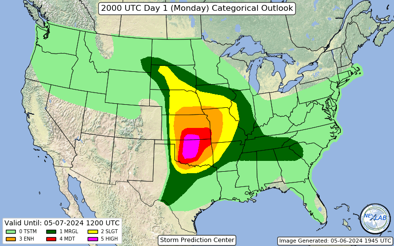
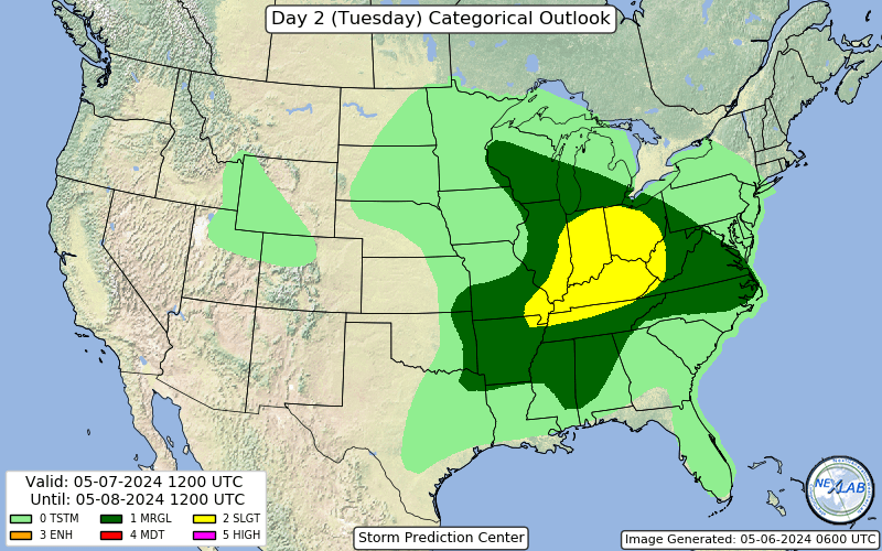
Categorical Outlook
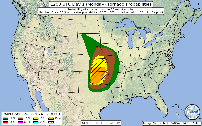
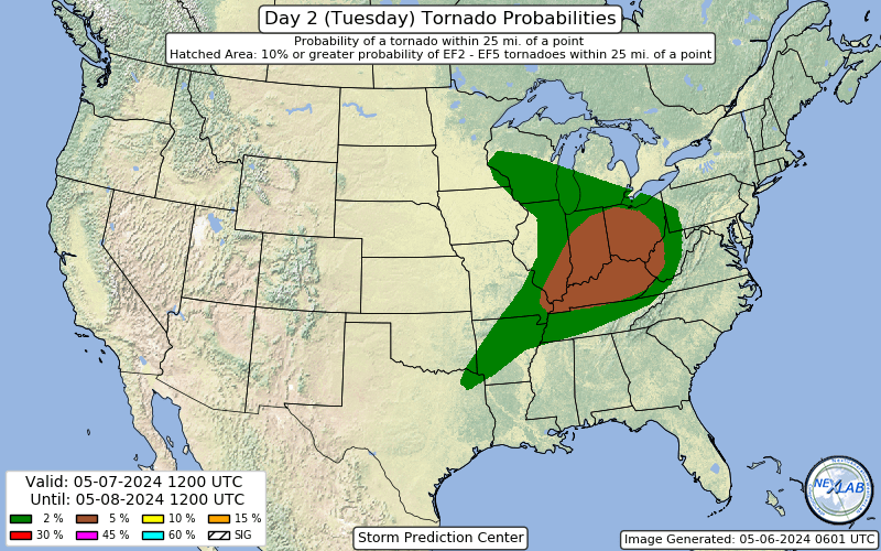
Tornado Probability
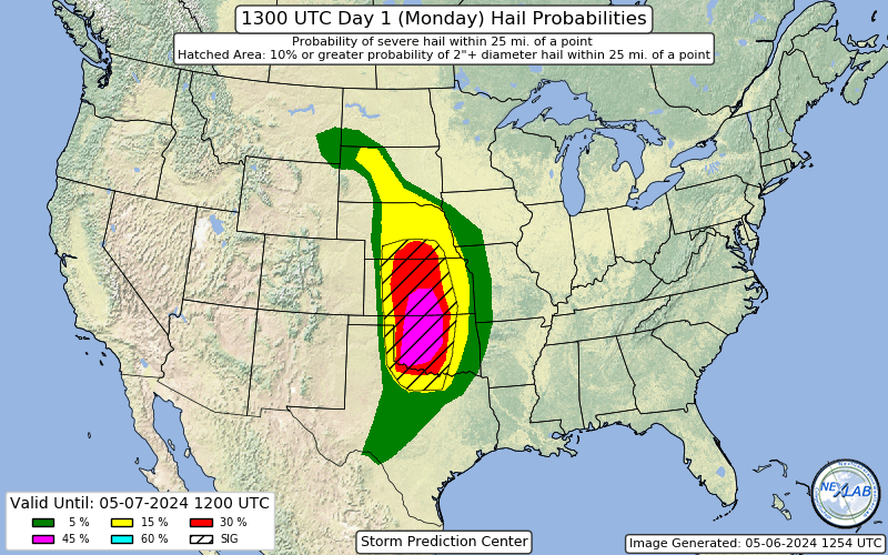
Hail Probability
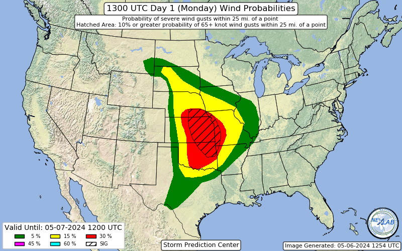
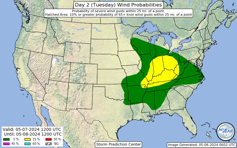
Wind Probablility
Categorical Outlook
Tornado Probability
Hail Probability
Wind Probablility
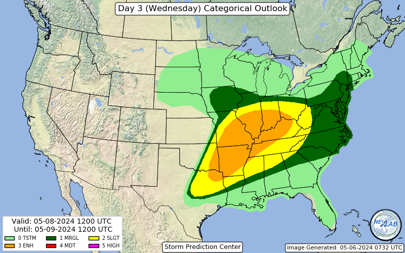
Categorical Outlook
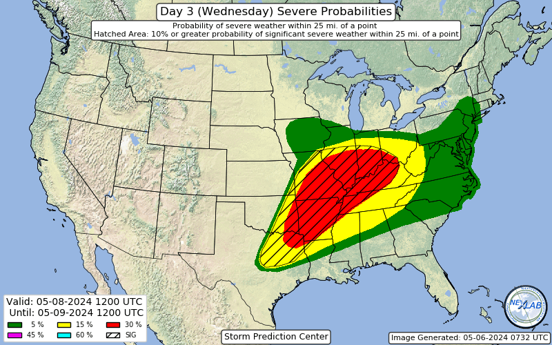
Severe Probability
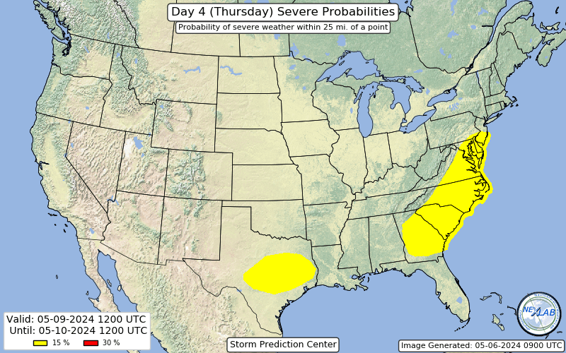
Day 4 - Graphic
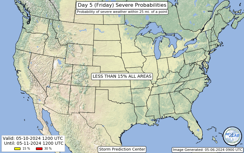
Day 5 - Graphic

Day 6 - Graphic

Day 7 - Graphic
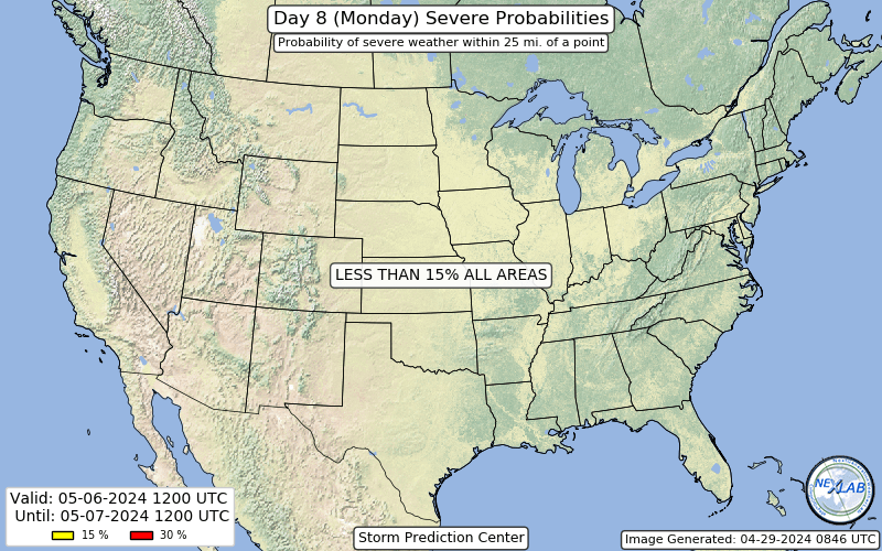
Day 8 - Graphic
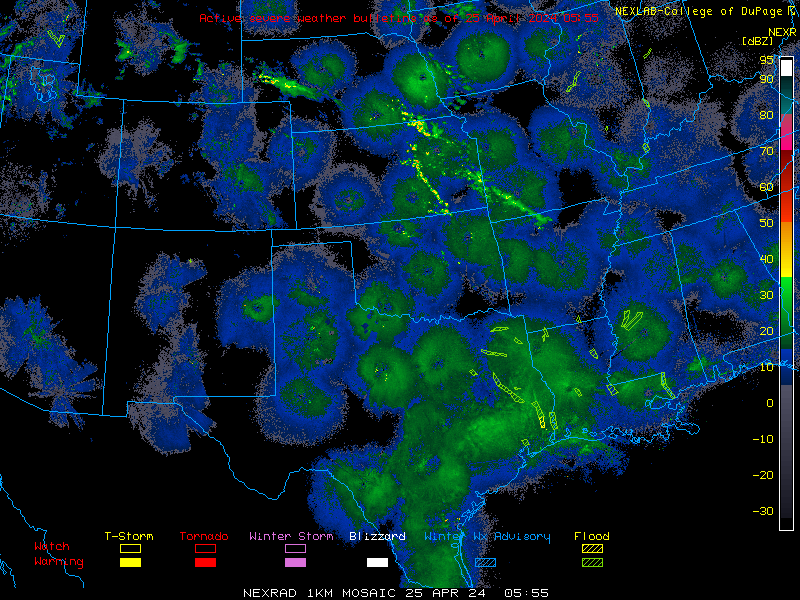
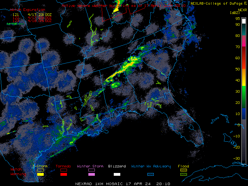
 The Nexlab Home Page